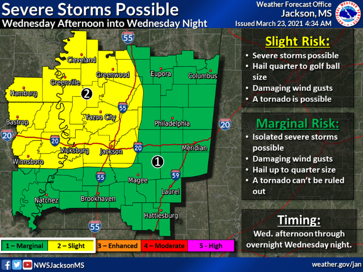
According to the National Weather Service, as a warm front moves north, it will bring in a warm and unstable airmass. Severe storms will be possible near and south of this front. Hail, damaging winds, and possibly a tornado will be of concern late this afternoon. The threat will continue overnight.

Here’s a look at your statewide forecast:
To the north, partly sunny with a slight chance of afternoon showers and thunderstorms. Highs in the mid 70’s. Cloudy tonight with a chance of shower and thunderstorms then showers and thunderstorms after midnight. Lows in the lower 60’s.
In central Mississippi, mostly cloudy with a slight chance of morning and afternoon showers with a chance of thunderstorms throughout the day, Highs in the mid 70’s. Tonight, showers and thunderstorms likely. Lows in the lower to mid 60’s.
To the south, cloudy with morning and afternoon showers and thunderstorms likely. Highs in the mid 70’s. Showers and thunderstorms tonight with lows in the mid 60’s.
The post Mississippi Weather Outlook for Wednesday, March 24th appeared first on SuperTalk Mississippi.


