


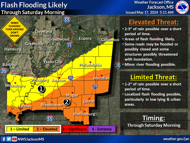
Severe storms capable of producing damaging winds to 70 mph, tornadoes; some strong, and hail to golf ball size are likely today.
According to the National Weather Service in Jackson, the highest risk for severe weather including the possibility for strong tornadoes is likely along and east of I-55. Storms will end from the northwest to the southeast as a cold front progresses across the area by late morning in the Mississippi River Delta areas and this evening in the Pine Belt.
Some school districts in the Pine Belt and other areas of Mississippi have announced closures or early dismissals to make sure students are safe.
The post Severe weather likely across Mississippi appeared first on SuperTalk Mississippi.